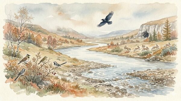
I used to imagine Neanderthals as fixed to their caves — born in one, living in it, dying in it. That image is completely wrong. The evidence tells a different story: one of planned movement, seasonal camps, landscape-scale knowledge, and connections stretching across dozens or even hundreds of kilometers. Neanderthals were not sedentary. They were mobile, strategic, and intimately acquainted with the geography of their world. Their teeth, their tools, and their campsites all tell us this — if we know how to read them.
What Do Neanderthal Teeth Tell Us About How Far They Traveled?
One of the most powerful tools for reconstructing Neanderthal mobility is strontium isotope analysis of tooth enamel. As teeth form during childhood, they incorporate strontium from food and water, and the ratio of strontium isotopes varies with local geology. By measuring these ratios in Neanderthal teeth and comparing them to the geological signatures of different landscapes, researchers can determine where an individual spent their early years — and whether they later moved to a different region.
At Payre in the Rhône Valley of southeastern France, strontium isotope analysis of three Neanderthal teeth combined with lithic provenance data revealed that these individuals spent their childhoods in the same general area where their remains were found — moving between the valley floor and the surrounding limestone plateaus. The foraging area suggested by both the dental evidence and the stone tool sources was consistent: a territory spanning roughly 20 to 30 kilometers in different directions, with movement organized along north-south corridors on the ridges and eastward following the river.
At Lakonis Cave on the Mani Peninsula in Greece, strontium isotope analysis of a Neanderthal tooth indicated a childhood mobility range of approximately 20 kilometers — consistent with the territorial range suggested by local raw material procurement. At Fumane Cave in Italy, isotopic analysis revealed differences in mobility between Neanderthals and later Upper Paleolithic modern humans who occupied the same cave, with one Homo sapiens individual showing evidence of a childhood spent in a geologically different region. These dental studies consistently point to Neanderthal territories measured in tens of kilometers — not the few hundred meters from cave to riverbank, but genuine landscape-scale mobility.
How Far Did Neanderthals Carry Their Stone Tools?
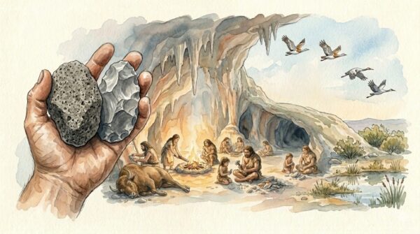
Lithic provenance analysis — identifying the geological source of stone tools and comparing it to the location where the tools were discarded — is the most widely used method for studying Neanderthal migration patterns. The results reveal a consistent but regionally variable pattern across Europe.
In western Europe, particularly in France and Iberia, the majority of stone tools at Neanderthal sites were made from raw materials sourced within five kilometers. This has sometimes been interpreted as evidence of limited mobility. However, a closer look reveals a more complex picture. At every major Neanderthal site, a small but significant fraction of tools originated from much greater distances — 20, 30, and occasionally over 100 kilometers away. These distant materials were typically the highest-quality flints, often already shaped into finished Levallois flakes or retouched tools, carried as part of a mobile toolkit.
At Abric Romaní in northeastern Spain, a systematic study of chert provenance identified primary procurement areas between 16 and 24 kilometers from the site, with different occupation layers showing different mobility strategies — some consistent with foraging-radius movements, others suggesting longer logistical expeditions. At Teixoneres Cave, also in Spain, researchers documented a clear distinction between locally knapped quartz tools and imported chert and other rock types brought from a radius of at least 15 kilometers, revealing that Neanderthals arrived at the site already equipped with a planned toolkit.
In central Europe, transport distances were often greater. Raw materials have been traced to sources exceeding 100 kilometers from their discard location, with some exceptional cases reaching 200 kilometers or more. These longer distances may reflect the more dispersed distribution of high-quality flint in steppe and boreal environments, requiring Neanderthal groups to trek greater distances between resource patches.
Did Neanderthals Follow Seasonal Rounds?
The faunal evidence strongly suggests that Neanderthal movement was structured by seasonal cycles. At Salzgitter-Lebenstedt in Germany, specialized autumn reindeer hunting left behind extensive remains from animals killed during their annual migration. At sites in the Dordogne of France, different caves show faunal assemblages dominated by different seasons — some with spring-birthing prey, others with autumn-hunted adults — suggesting that Neanderthal bands rotated between camps on a seasonal schedule, returning to the same locations generation after generation.
Some sites show evidence of sustained occupation lasting weeks or months, while others contain thin, rapidly deposited layers suggesting brief stopovers. This pattern — a few long-duration base camps supplemented by shorter-term task-specific sites — is consistent with the “residential mobility” model documented among modern hunter-gatherers, where the entire group moves between a small number of seasonally preferred locations.
Cave sites in the Levant show particularly clear evidence of seasonal cycling. At Tabun and Kebara Caves in Israel, Mousterian occupation layers alternate between periods of intensive use and apparent abandonment, consistent with groups moving inland during cooler months and returning to coastal zones during warmer seasons. The same pattern appears in Iberia, where coastal cave sites like Figueira Brava show intensive marine resource exploitation during specific periods, while inland sites show corresponding faunal assemblages dominated by terrestrial game.
Did Neanderthals Visit Neighboring Groups?
Genetic evidence makes clear that Neanderthal bands were not reproductively isolated. The 2022 Chagyrskaya study showed that communities were connected through female migration between groups — women moved to new bands, carrying genetic diversity with them. This requires intergroup contact. At minimum, neighboring bands must have encountered each other regularly enough for individuals to transfer between them. Whether these encounters were planned — deliberate visits to known neighboring groups — or opportunistic is unknown, but the sustained gene flow over generations implies a degree of predictability.
The raw material evidence reinforces this interpretation. At Chagyrskaya and Okladnikov Caves in the Altai — separated by approximately 100 kilometers — the same distinctive raw materials appear at both sites, supporting the genetic evidence that the groups inhabiting them were closely connected. In the Aquitaine Basin of France, refitting studies — physically matching stone flakes to the cores from which they were struck — have demonstrated that the same core was sometimes knapped at multiple locations, with flakes discarded at different sites along a movement route. This proves that Neanderthals carried tools across landscapes and that their movements connected different locations into a coherent territorial system.
What This Suggests About Neanderthal Intelligence
The mobility evidence demands cognitive capacities far beyond simple wandering. Seasonal movement between fixed locations requires spatial memory, temporal planning, and the ability to anticipate resource availability weeks or months in advance. Carrying a curated mobile toolkit — pre-made tools selected for anticipated tasks at distant locations — requires forward planning and mental modeling of future needs. Navigating between sites separated by 20 to 100 kilometers across Pleistocene landscapes without maps, compasses, or trails requires an intimate mental geography of the terrain built up over years of experience and transmitted across generations. This is not the behavior of a species operating on instinct. It is the behavior of a species that thinks ahead.
What This Means Today
We tend to associate mobility with freedom and settlement with civilization, as if staying in one place represents progress. The Neanderthal evidence inverts this assumption. Their mobility was not aimless — it was strategic, seasonal, and knowledge-intensive. They moved because they understood their landscape deeply enough to know where to be and when. Modern concepts of sustainable land management — rotating resource use, matching consumption to seasonal availability, maintaining connectivity between habitats — are principles that Neanderthals practiced for hundreds of thousands of years. Their geography was not a limitation. It was a technology — and understanding Neanderthal daily life requires recognizing that movement itself was a central feature of Neanderthal society.
How Neanderthal Mobility Depended on Ecological Knowledge
Every seasonal move required ecological intelligence. Knowing when reindeer herds would cross a specific river ford. Knowing where flint outcrops were exposed and which produced the highest-quality material. Knowing which valleys offered shelter from winter winds and which south-facing slopes held the last autumn plants. This knowledge was the accumulated inheritance of generations — a mental map of the landscape that encoded not just geography but seasonality, resource quality, and risk. Losing access to this knowledge — through population decline, territory displacement, or the death of key elders — would have been as catastrophic as losing access to food or fire.
Lesser-Known Facts
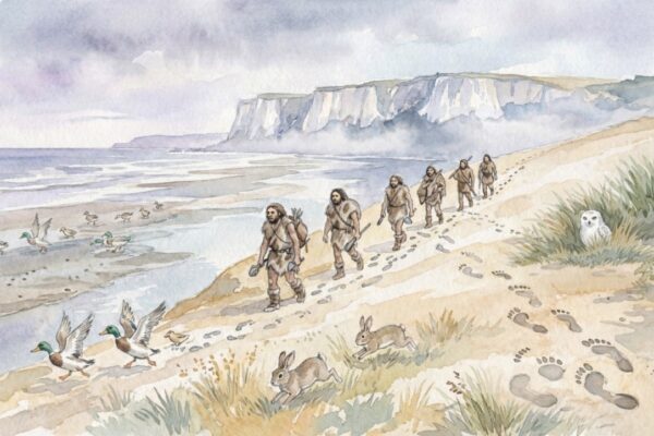
Strontium isotope analysis of Neanderthal teeth consistently shows childhood mobility ranges of approximately 20 to 30 kilometers — not the sedentary cave-dwellers of popular imagination, but genuine landscape-scale foragers. In central Europe, some stone tools found at Neanderthal sites originated from raw material sources over 200 kilometers away. At Le Rozel in France, Neanderthal footprints preserved in coastal dunes suggest the group visited the shoreline specifically during periods of favorable tides — implying knowledge of tidal patterns and seasonal coastal conditions. Refitting studies have shown that individual stone cores were carried between multiple sites and knapped at different locations along a movement route, physically demonstrating landscape-scale connectivity.
Myth vs. Evidence
Common misconception: Neanderthals lived in one cave their entire lives, rarely venturing far from home. Evidence: Isotope analysis, lithic provenance studies, and faunal seasonality data all demonstrate that Neanderthals practiced structured seasonal mobility across territories spanning tens of kilometers, with connections to distant groups extending over 100 kilometers or more.
Try This
Look at a map of the area within 30 kilometers of your home. Note every distinct terrain feature — rivers, ridges, valleys, forests, open ground. Imagine navigating this landscape on foot, without roads, knowing where to find water, food, stone for tools, and shelter in every season. That mental map, updated continuously and transmitted to the next generation through years of walking together, was the Neanderthal equivalent of infrastructure — invisible, indispensable, and irreplaceable.
What We Still Don’t Know
Did all Neanderthal groups practice seasonal mobility, or were some populations more sedentary than others? How did territorial boundaries work — were there contested zones between neighboring bands? Did Neanderthals use landmark navigation, celestial navigation, or some other wayfinding system? How did the arrival of Homo sapiens affect Neanderthal territorial ranges — did competition force them into smaller or less productive territories? And how long did it take a young Neanderthal to learn the full seasonal round — to build the mental map that would sustain them for a lifetime? These questions remain open, awaiting new isotopic data, more extensive lithic sourcing studies, and continued excavation of the seasonal sites that punctuate Neanderthal landscapes across Europe and western Asia. Each answer will deepen our understanding of Neanderthal society and the ecological intelligence that sustained it.
Summary
Neanderthal migration was not random wandering — it was structured, seasonal, and strategically planned. Strontium isotope analysis of teeth reveals childhood mobility ranges of 20 to 30 kilometers. Lithic provenance studies show raw material transport over distances ranging from five to over 200 kilometers, with curated mobile toolkits carried between sites. Faunal seasonality data demonstrate that Neanderthal bands rotated between camps on predictable annual cycles. Genetic evidence confirms that bands were connected through female migration, maintaining social networks across landscapes. This Paleolithic mobility was an Ice Age survival strategy grounded in deep ecological knowledge, forward planning, and intimate familiarity with the geography of a world without maps — a testament to Neanderthal intelligence and the sophistication of their daily life.
![]()